


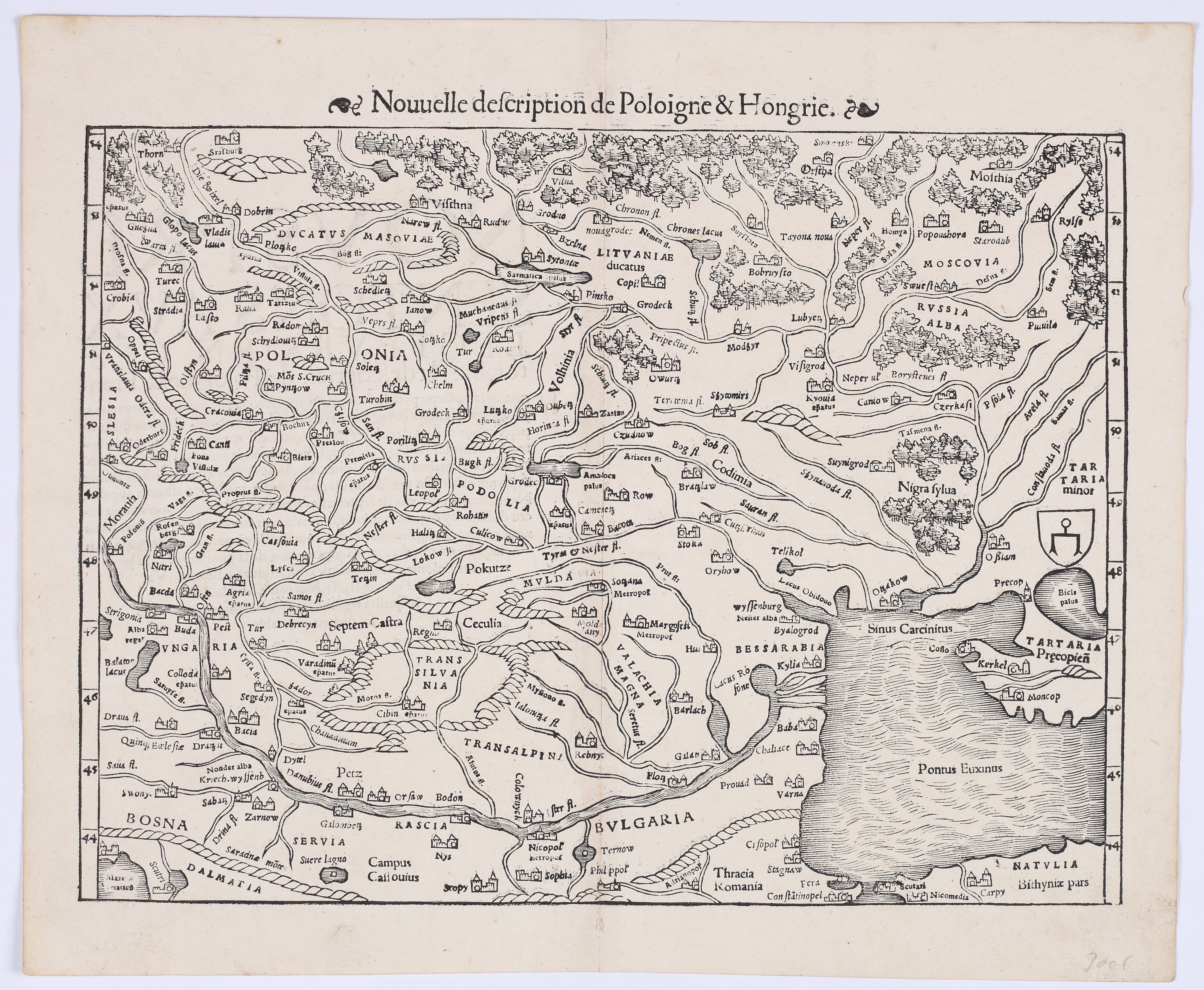
MÜNSTER, Sebastian (1488–1552) — *Nouvelle description de Pologne & Hongrie*. Basel: Heinrich Petri, 1552.
Woodcut, paper, 260 × 345 mm on a sheet measuring 320 × 385 mm, with text in French on the reverse. The paper is slightly yellowed, with traces of atlas-style folding.
A beautiful map of Poland, Hungary, and the surrounding regions of Eastern Europe, titled *Nouvelle description de Pologne & Hongrie* along the right margin, taken from the French edition of Münster’s *Cosmographia*.
Sebastian Münster (1488–1552)—a German cartographer, cosmographer, and Hebrew scholar—taught at the University of Basel. His most important work, *Cosmographia*, first published in Basel in 1544, was the first German-language description of the world and a significant work in the development of geographical thought in 16th-century Europe. Between 1544 and 1628, *Cosmographia* appeared in 24 editions, and its popularity stemmed, among other things, from its numerous, striking woodcuts, some of which were created by Hans Holbein the Younger and Urs Graf. Münster continuously expanded and supplemented *Cosmographia* until his death. A hallmark of his work was his ability to obtain maps, views, and descriptions from his contemporaries—often those directly connected to the places depicted—making many of the illustrations the earliest surviving cartographic and visual representations of those areas.
The map of Poland and Hungary presented here is an excellent example of this: it was based on a lost map by the Polish cartographer Bernard Wapowski from 1525, serving as a rare surviving testament to a source that has not survived to the present day.
The map depicts the ancient territory of European Sarmatia, encompassing the lands of present-day Poland, Hungary, Ukraine, Belarus, Moldova, and parts of the Balkans and western Russia. The map is rich in detail: rivers, mountain ranges shown in profile, forests depicted as clusters of trees, and numerous cities and regions labeled with names in Latin and in the local languages. Among the major regions are Polonia, Masovia, Volhynia, Lithuania, Podolia, Russia Alba, Moscovia, Wallachia, Bessarabia, Bulgaria, Bosnia, Dalmatia, Tartary, and Transylvania. In the lower left corner, the Black Sea is depicted, with the river systems of the Danube and Vistula clearly marked. On the reverse side is a printed text in French describing the map’s geographical scope.
Imago Poloniae K5/7.










Последно разглеждани позиции
Влезте, за да се запознаете със списъка с артикулите
Любими
Влезте, за да се запознаете със списъка с артикулите